R-16-05 Lost to the sea: ancient coastal heritage
Alice R. Kelley
School of Earth and Climate Sciences & Climate Change Institute
University of Maine
Joseph T. Kelley
University of Maine
Daniel F. Belknap
University of Maine
Arthur Spiess
Maine Historic Preservation Commission
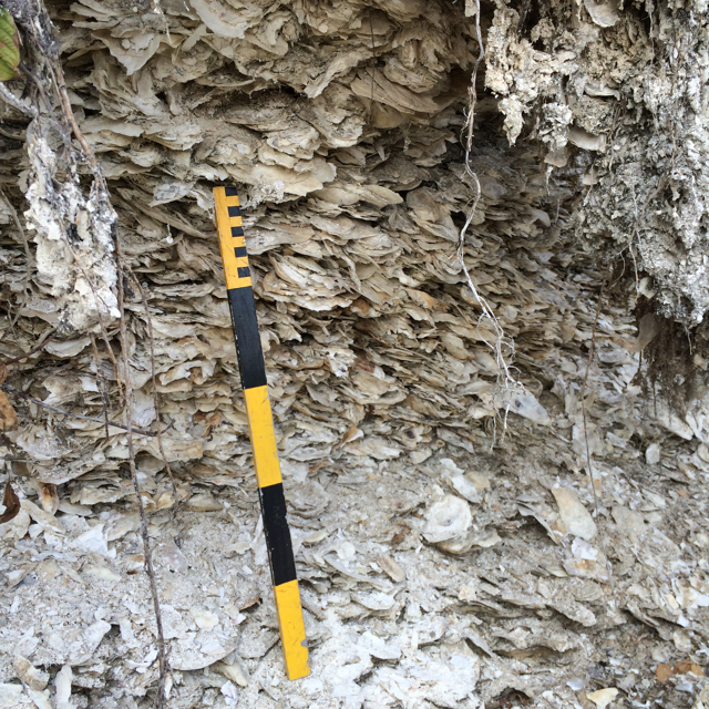
Archaeologists have documented approximately 2,000 Native American shell middens along the coast of Maine. The piles of oyster and clam shells, left by the ancestors of the Wabanaki people, range from 2,000 to more than 4,000 years old. Buried within the shells is a unique record of human occupation and coastal adaptation—historical, scientific, and cultural information of great value. But given limited resources, archaeologists can only excavate about three sites per year. Meanwhile, more and more of these features are slipping into the water with every high tide and wake from passing boats.
Maine is experiencing an increase in the rate of sea-level rise, from around 1 millimeter per year to 2 mm/year today, with projections of 20 mm/year by mid-century. While this situation is the latest in a long and complicated history of Maine’s shoreline, it presents a challenge. Given the scale of the problem, land managers will not be able to protect all sites. Kelley and her colleagues propose to evaluate the use of ground-penetrating radar (GPR) technology as a rapid, non-invasive, and low-cost tool to characterize and rank archaeological sites. GPR uses short pulses of radio-frequency electromagnetic signals transmitted into the ground, where the signals are reflected by soil, rock, and other subsurface material, each of which has different electrical properites based on density, grain size, water saturation, etc. Midden and associated occupation area dimensions obtained from eight eroding sites will be combined with calculated rates of shoreline change to develop a culturally and environmentally sensitive approach to guide prioritization and decisions about which areas to excavate and/or protect.
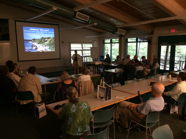
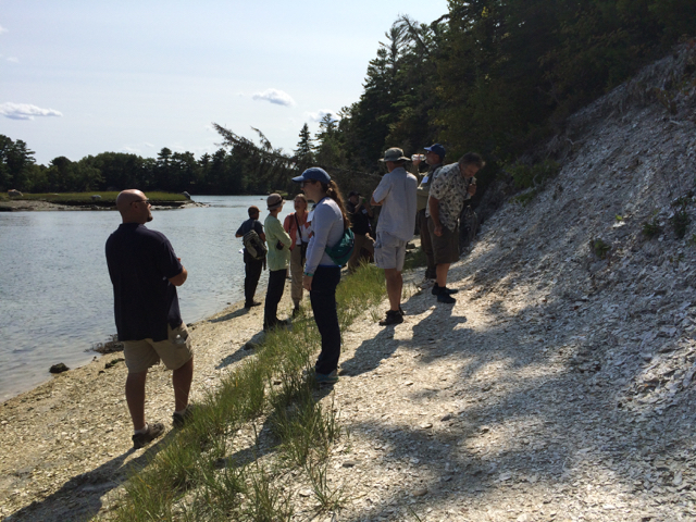
In August 2017, Maine Sea Grant hosted a workshop to bring together residents of coastal communities, tribal representatives, resource managers, and conservation groups to address issues of site access, monitoring, and preservation. The two-day workshop, which included a field trip to the Whaleback Midden State Historic site and discussions at the Darling Marine Center, addressed the question, How can stakeholders help to monitor, rescue, and protect shell middens in Maine? Read the workshop summary (PDF).
The erosion of natural and cultural coastal resources due to rising seas is a worldwide problem, and this project positions Maine with a global debate about how to address the matter being “lost to the sea.”
Total project costs $264,312 (Sea Grant funds $142,395)
Stories about the project:
Native American secrets lie buried in huge shell mounds, The New York Times
Gather and Feast, Past and Present, Maine Sea Grant
Citizen scientists may help save Maine’s ancient garbage piles, Bangor Daily News
Ancient shell middens speak of climate and culture, The Working Waterfront
Shell middens may be lost to the sea, Mount Desert Islander
10 x10 Midden, from Outside/In on New Hampshire Public Radio
Preserving Maine’s ancient coastal heritage, University of Maine